Day 2: Tuesday, July 23rd 2024
Today, I’d been told, was the toughest day. But that’s if it’s your penultimate, I kept telling myself. It’s only my second. I’d be full of energy and determination.
I didn’t sleep too well. Consciously or not, I was concerned about my clearly absent way-finding skills, and adding miles to an already big day. Squinting at the crack between the curtains I could see sunshine, which was encouraging; at least I could pack away the waterproof trousers that had begun to cause a bit of a rash around my nether regions during their hard work yesterday. Gratefully pulling on my faithful denim shorts, my default walking gear, I also noted the absence of aches. Perhaps I had been worrying for no reason. To be on the safe side, though, I called into the village shop on my way past (having ascertained that it was, in fact, the way) and bought two cans of energy drink. I can never forget my scaling of Beinn Alligin, when I sat down a hundred metres below the main summit, squinting up at the ridge and wondering how I was going to make it. Strong, intrepid walker I may be, or at least that’s how I like to think of myself, but I’m not very good at it. I find the ascents exhausting; I can honestly say I begrudge every agonising, panting step until I’m on top – when, of course, that all changes. On this occasion I sat on a rock and pulled out a can of Red Bull. I’m not sure how I came to possess such a thing as I didn’t like it much, but as soon as I’d finished it, I grew the proverbial wings. I sailed up the slope barely touching the ground. From then on, a can of the evil stuff was an essential component of my mountain kit and I kept one in my daypack at all times. I had not imagined I’d need one for the rolling Dales, but I thought of it as insurance.
I became lost almost immediately. A couple in their thirties were also in the shop, buying what looked like components of a lunch. They were dressed for walking, and we struck up a conversation. They were from Belgium; they, too, were doing the Way, but, naturally, in the opposite direction. We walked together to the trail, where they would turn left towards Bowness and I in the direction of Sedbergh, from where they’d come yesterday. As I had entered Burneside from a completely different direction, I confessed I didn’t know where the path was, and they were happy to show me. Horrified that I was attempting to do the walk without a proper map (unable to find one single map covering the whole route and unwilling to carry – or purchase – five), the kind man donated theirs, which was no longer in use now they were on the final leg. Now, we all agreed, I’d be alright for today. Nothing could go wrong this time. Could it?
Within the hour I reached a very fast road. The book described a somewhat unpleasant, but short, section along the A6 before crossing to the other side and continuing along a track. I duly crossed over, and looked for a turning on my right. I came upon a narrow driveway with a wooden sign advertising a boarding kennels. It looked like a private road, so this couldn’t be it. I continued on.
After about thirty minutes of slog against the flow of traffic, I found a footpath into an empty field showing evidence of recent cow activity. The path soon petered out, so I crossed the field assuming a stile or gate at the other side, through which the way would presumably emerge. It was a fairly large field, and I walked the entire circumference without finding an exit. Back onto the road I went, and tried the next field. This one had an opening into another field, and another. Looking at the map, I was heading in the right direction, but had somehow missed the correct turnoff. It must have been the road to the kennels, but as I was about an hour away by now, I couldn’t risk going back, only to find it wasn’t the correct way after all. I was already losing time, becoming hot and a little bit bothered. I was prepared to crawl through hedges now, in the absence of openings, but luckily these fields were more manicured and I arrived at a grand-looking farmhouse where a Collie dog barked and a lady turned to look at me. I was a mile or so out of my way, she told me, but if I just walked down her long driveway, I would eventually reach the track I should have taken. No harm done, and obstacle Number One was out of the way.
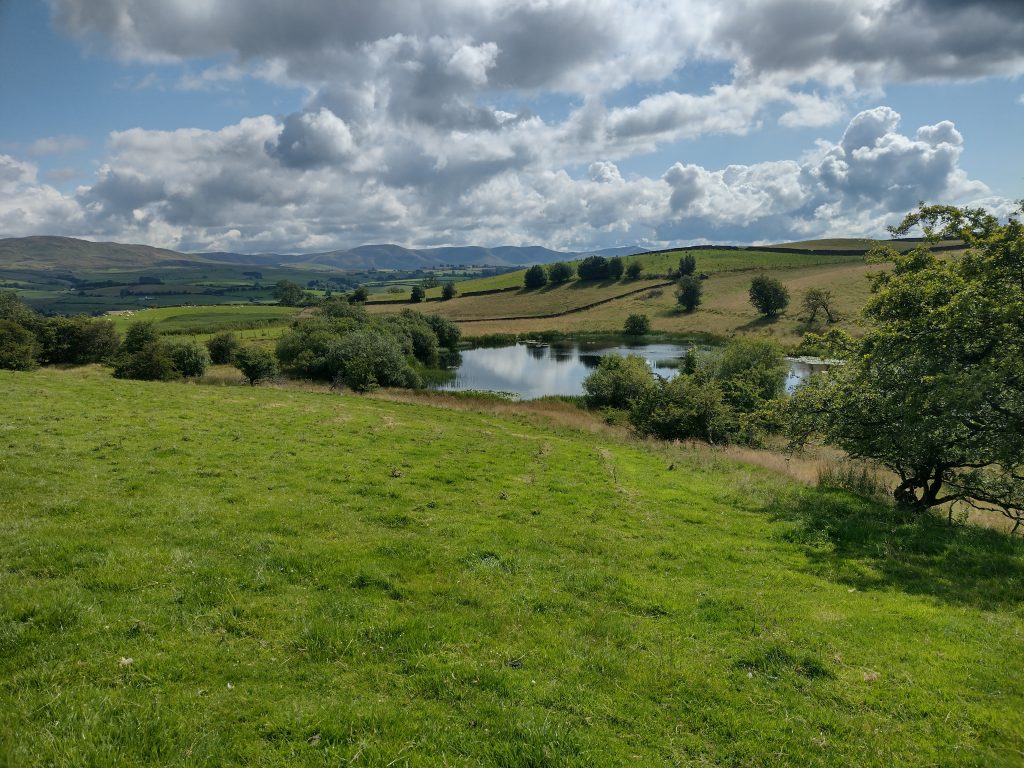
I took out my coffee on a sunlit boulder beside a peaceful pond full of lily pads. Its shores were lined with stunted oaks and hawthorn bushes, reminding me of the Downs of my youth and the dried-up dew pond where I first tried landscape sketching. I wished I had the time now, and could have carried a sketchbook with me, but the days were turning out to be long enough as it was, and I had to absorb as much joy and beauty as possible during these brief, stolen moments.
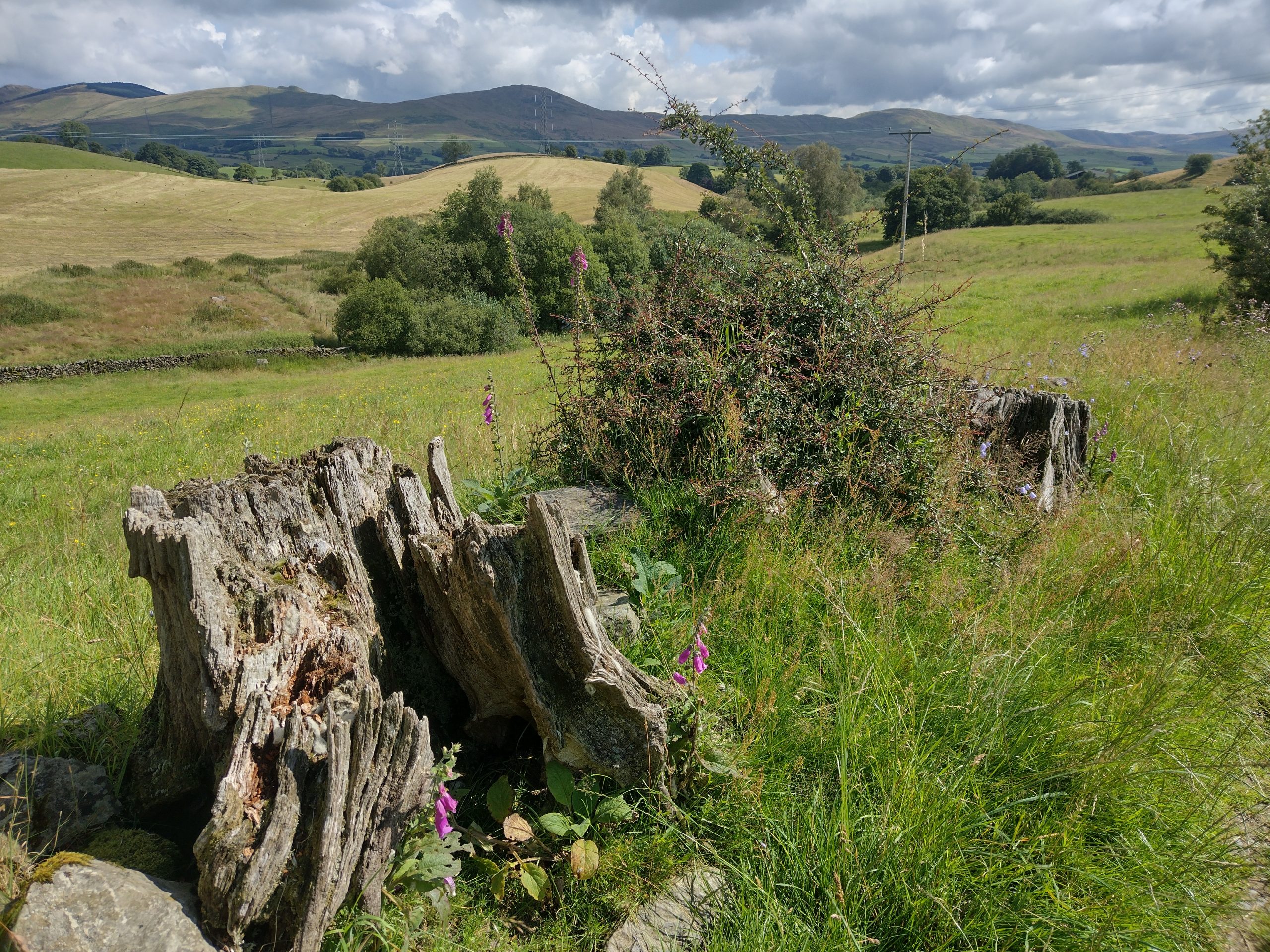
The scenery now was wide, open and neither Lakeland nor Dales. This day has the reputation of being both the toughest (due to mileage) and the least scenically interesting, but I enjoyed the unfamiliarity, as I had yesterday. It was all new to me, and, hence, surprising. Not least when I once again took a wrong turn across a (marked) unsafe, rotten bridge to a dead-end sign marked ‘Beware of the Dog,’ and then had to negotiate a narrow path overhung with nettles. These I find irrationally terrifying at the best of times, and I now had to hold them to one side using my backpack to enable me to pass safely with my bare legs. Somewhere in the middle of the heinous patch, I narrowly avoided a panic attack; I halted, paralysed, unable to find a way neither forward, nor backward, without physically wrestling the demonic things. A few deep breaths showed me the solution, but it was touch and go. Under no circumstances was I going to retrace this section, no matter how far out of my way I was going. Thankfully, I was on the right track.
By lunchtime the day was really heating up. Crossing the river Mint via a wooden bridge, I paused to watch a German Shepherd swimming for a stick while its human stood, knee-deep, in the inviting, gently flowing, shaded water. If I wasn’t already behind schedule, and certain to become lost again, I would have been very tempted to join in. As I rather reluctantly panted up the sunbaked slope towards some farm buildings, I heard heavy breathing behind me and stepped aside to allow a handsome, Italian-looking fellow flash past me and hoof it up the hill. By the time I summited a crest, overlooking a long, stony track snaking miles into the distance ahead of me, he was almost out of sight, and I was already exhausted. I plonked myself down and took out a muesli bar, trying (and failing) to recall a time in my life that I’d ever been as fit as he.
I found this part of the route a bit boring; the track, subsequently turning to tarmac, monotonous, with the roar of heavy traffic looming ever closer. This is the part where one must cross the M6, which resembles a parallel universe when come upon like this, and it appears infinitely busier and faster than it ever does while driving along it. I made a mental note to look up at this concrete footbridge the next time I’m on my way to Scotland, and spare a thought for anyone looking down at me amongst the throng of noise, speed, pollution and, what would seem to them at that moment, pointless haste.
My lunch-stop goal for the day lay somewhere beyond the M6; I was late on parade, and hungry, so for want of somewhere better I sat in the middle of a featureless, scrubby field and looked around for an exit whilst eating my sandwich. I slipped my boots off and wiggled my toes; so far, they were holding up, but they did appreciate the freedom, and I still had some way to go.
The next challenge was finding my way out of the field. With no clear track, and no gates or stiles in sight, I once again had to rely on my unreliable instincts and headed diagonally down and across the field. There were some buildings in the corner, a farmhouse and what looked like a lane. On closer inspection I found one of the Dales Way’s infamous honesty boxes, a trunk filled with ice-cold drinks which made me salivate. At just £1 a can, I would have loved to rub one across my forehead if nothing else, but alas, I had failed to bring cash with me. Kicking myself, I put the thought of cool, fizzy sweetness out of my mind. If I reached Sedbergh in good time I could reward myself at the supermarket, or even the pub!
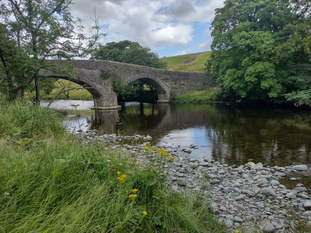
The optimism was short-lived. I reached the Lowgill viaduct and spent a good twenty minutes marching up, down and around, trying to find a possible route. In the end I plumped for going under it, away from the road. It made sense, though there wasn’t a sign to be seen. Eventually, a narrow tarmac road took me downhill through trees to some attractive and expensive-looking houses beside a tumbling stream, feeding the River Lune. A little way on I came upon the Crook of Lune stone bridge, apparently marking the original border between Westmorland (now swallowed into Cumbria) and the West Riding; after two days, I had crossed into Yorkshire.
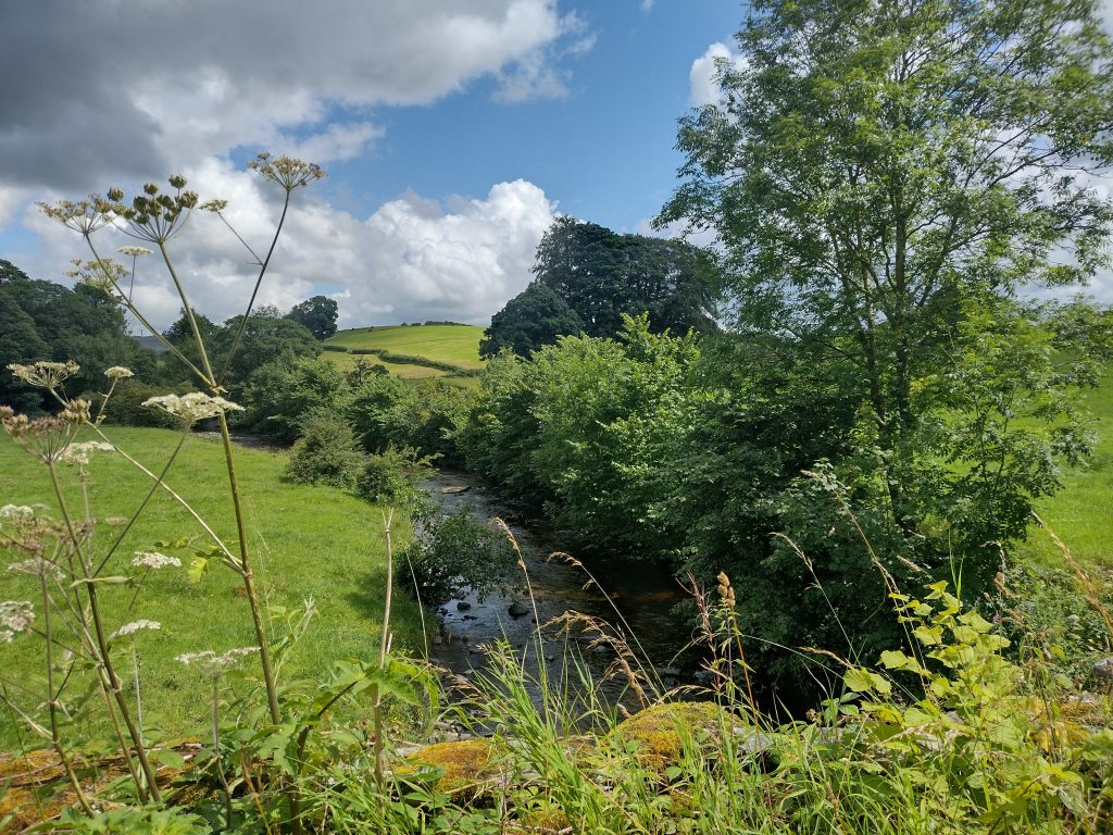
Although I was on a tarmacked road, it felt like the middle of nowhere. Surely, I should be nearing my destination at this point? I crossed the bridge, sat on the edge at the far side and studied the map. I wasn’t sure if my legs or my brain was the more tired by now, but neither was enthusiastic about the three or four miles I still had in front of me – assuming I didn’t take any unscheduled detours, which was asking a lot. The way supposedly followed the river, which was looking beautiful indeed. But it was getting late, and I was done. Dreaming of a way to transport myself effortlessly along the riverbank and directly into Sedbergh in the fading afternoon sunlight, where I may remove my boots and recline with something cold, a white car eased across the bridge, the driver’s window down. Noticing me with map in hand, he smiled. It was still a few miles to Sedbergh, he said, and he was heading in that direction. The offer was more than I could resist. Though disappointed as much with the ‘cheating’ as with missing out on what is probably the most beautiful section of the day’s walk, I accepted gratefully. As I trudged up the main street of Sedbergh and found the house where I would stay the night (which I had to myself, as the interesting-sounding owner was, himself, away), I knew I would have been extremely grumpy if I had carried on, and probably limping, too. I vowed to do better the next day; I simply had to stop going astray.
Extra miles (estimated): 2
Miles skipped: 4
Official time: 8 hours
Time spent being lost: 2-3 hours
Time saved by cheating: 2 hours
Total time taken: 9 hours
Difficulty rating: Apart from wayfinding and mud around the gates, the walking wasn’t too difficult today. But it felt like a long, long way.